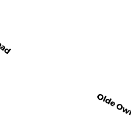
160 OLDE OWL POND ROAD
Owner Information
KENNY MARGARET R &
160 OLDE OWL POND ROAD
BREWSTER, MA 02631


Property Details
160 OLDE OWL POND ROAD is classified as a Single Family Residential (Contempor).
The primary structure on this property was built in 1995. There are 3,408ft2 of built area within this property. There is 3,408ft2 of residential/living space within this property. This property is listed as having 7 rooms.
160 OLDE OWL POND ROAD is valued at $1,045,900. The land is valued at $272,900 and the structures are valued at $699,100. There is an additional valuation of $73,900 on this property.
This property is in Zone RR. Confirm with local Zoning Board authorities to ensure there are no overlays or other easements on this property.
160 OLDE OWL POND ROAD was last sold on Tuesday, December 1, 1992 for $145,000.
Assessment data from fiscal year 2022.
Flood Data
According to the FEMA National Flood Hazard Layer, this property does not appear to be in a flood zone. It may also be in an area not yet reviewed. Nonetheless, confirm this information prior to taking any action.
To view the flood hazards around this property, create a FEMA "Firmette" Map of the area around 160 OLDE OWL POND ROAD.
Broadband Internet Providers
| Provider | Type | Bandwidth (mbps) | |
|---|---|---|---|
| Viasat Inc | Satellite | 35 | 3 |
| VSAT Systems, LLC. | Satellite | 2 | 1 |
| HughesNet | Satellite | 25 | 3 |
| GCI Communication Corp. | Satellite | 0 | 0 |
| T-Mobile | Fixed Wireless | 25 | 3 |
| Comcast | Cable | 1000 | 35 |
| Verizon New England Inc. | DSL | 5 | 0 |
Broadband service provider data from December 2020.
Adjacent Properties
- 0 OLDE OWL POND ROAD
Vacant, Conservation (Municipal or County) owned by BREWSTER TOWN OF - 0 OLDE OWL POND ROAD
Undevelopable Residential Land owned by HIGGINS CRAIG L TRUSTEE - 14 JAM LANE
Single Family Residential owned by STOCKS RICHARD W & SHARON C - 0 BAKERS POND ROAD
Vacant, Conservation (Municipal or County) owned by BREWSTER TOWN OF - 0 JAM LANE
Vacant, Conservation (Municipal or County) owned by BREWSTER TOWN OF